
Typhoon Dolphin hurtles towards Japan: Tracker, updates and what to expect
 04 August 2026
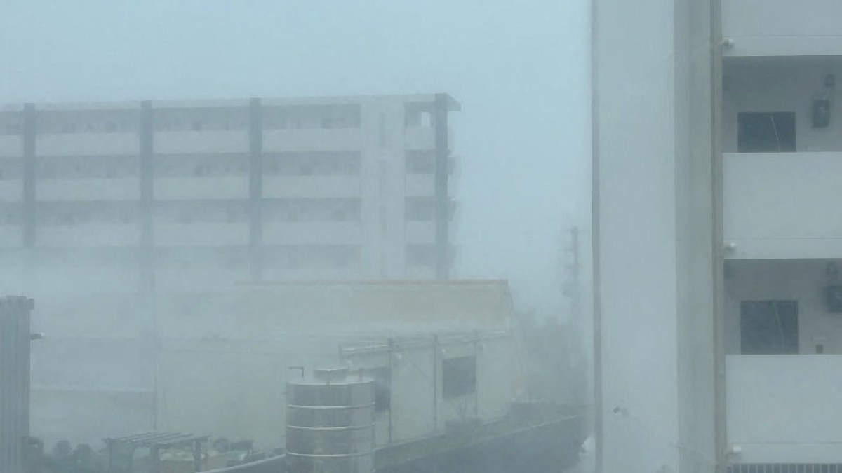

Typhoon Dolphin is heading westwards across the Pacific Ocean towards Japan, and residents of Okinawa Island have been urged to prepare for severe weather before its expected landfall this week.
Dolphin has taken a long voyage across the ocean, and as it approaches Japan, here’s what to expect in the coming days.
How strong is Typhoon Dolphin?
According to Zoom Earth, Dolphin is a “very strong typhoon” that was moving at 185 kilometres per hour (115 miles per hour) at 05:00 GMT on Tuesday.
It grew out of a tropical depression that emerged on July 26, moving at 45km/h (30mph) over the open waters of the Central Pacific Ocean as it embarked on a journey of several thousand kilometres across the Pacific.
Over the course of its journey, Dolphin strengthened to a tropical storm and then to a severe tropical storm before burgeoning into a typhoon and then a very strong typhoon on July 28.
It briefly became even stronger, escalating to the levels of super typhoon and violent typhoon as it continued to move northwest from Wednesday to Saturday before weakening back to a very strong typhoon on Sunday.
Where and when will Dolphin make landfall?
The typhoon battered the outer Japanese Ogasawara Islands, also called the Bonin Islands – the first part of Japan it reached – with strong winds on Tuesday.
The Japan Meteorological Agency (JMA) issued typhoon warnings and advisories for the islands in advance and is currently tracking Dolphin, which it described as a “large and very strong” storm, as it makes its way from the south.
Advertisement
The typhoon is expected to make landfall on Japan’s Okinawa Island on Friday morning.
The island, home to 1.4 million people, is the largest, most populated island in Japan’s Okinawa prefecture, which comprises hundreds of islands.
Local governments on the islands have advised residents to secure their homes, stay away from the coast and prepare for possible evacuations and power cuts. Ferry and flight disruptions are expected.
Last month, Typhoon Bavi made landfall in China’s eastern province of Zhejiang, also bringing heavy rains to Japan’s Okinawa prefecture.

What can we expect from the typhoon through the week?
- On Tuesday, the typhoon passed the Ogasawara Islands.
- On Wednesday, high winds will continue over the Ogasawara region.
- On Thursday, the typhoon will approach the Daito Islands and the Amami Islands.
- On Friday, it is due to hit Okinawa Island.
- On Saturday, strong winds and torrential rains are expected to continue..
You can track Typhoon Dolphin on Zoom Earth, an online platform with satellite imagery that shows weather patterns and is particularly useful for tracking storms.
Why is this storm called Typhoon Dolphin?
The typhoon has been named after Hong Kong’s Chinese white dolphins.
Individual hurricanes, typhoons and cyclones are named by the Typhoon Committee at the World Meteorological Organization (WMO), which maintains premade rotating lists of names.
For hurricanes originating in the Atlantic Ocean, these lists comprise typically male or female first names that are easy to remember.
The WMO’s lists of names for the western North Pacific’s storms include local animals, plants and cultural items. Dolphin was Hong Kong’s contribution.
Where else could Dolphin have an impact?
Besides Japan, the northern and eastern regions of Taiwan are likely to experience heavy rain, strong winds and high coastal swells due to the typhoon.
Additionally, coastal regions of southeastern and eastern China may experience heavy rainfall.
Last week, Typhoon Noul hit southern China, including Hong Kong, bringing strong winds and heavy rain to the region and prompting the evacuation of hundreds of thousands of people in Guangdong province.
Is a typhoon the same thing as a cyclone?
Hurricanes, cyclones and typhoons are all essentially the same thing. The main difference is where they originate. All three are storm systems with winds exceeding 118km/h (73mph).
Typhoons occur in the northwestern Pacific Ocean and frequently hit the Philippines and Japan. Typhoon season is most common between May and October, but the storms can form year-round. The strength of a typhoon has various classification scales with the most severe storms named super typhoons.
Advertisement
Cyclones occur in the South Pacific and the Indian Ocean, often impacting countries from Australia all the way to Mozambique. Cyclone season typically runs from November to April.
Hurricanes occur in the Atlantic Ocean and Eastern Pacific and often affect the East Coast of the United States, the Gulf of Mexico and the Caribbean. The strength of a hurricane is measured on a wind scale from 1 to 5. A Category 1 hurricane will bring sustained winds of 119-153km/h (74-95mph) whereas a Category 5 storm can exceed 252km/h (157mph).
Different agencies use different wind scales. Japan’s Meteorological Agency does not use the 1-5 category system applied to Atlantic hurricanes, and the wind-speed boundaries do not perfectly align.
What are the different types of storm?
There are several stages a storm can move through before it becomes a typhoon, each with differing consequences if it makes landfall.
Tropical depression
- The weakest stage of a storm
- Maximum sustained winds: up to 63 km/h (39mph)
- Organised system but below “storm” strength
- Damage: minor, localised impacts, such as short spells of heavy rain, strong winds, localised street floods. Concerns are largely limited to flash floods and landslides in vulnerable regions.
Tropical storm
- Windspeed: about 63–88km/h (39-55mph).
- Receives a name at this stage
- Damage: moderate. Tropical storms can cause disruptions to travel and damage crops. Additionally, they can damage weaker trees, power lines and weaker structures, such as road signs and light roofs.
Severe tropical storm
- Stronger but still below typhoon
- Windspeeds: 89-117km/h (55-73mph)
- Damage: serious but not catastrophic. Severe tropical storms uproot trees and lead to wider communications outages and greater infrastructural damage and crop losses.
Typhoon
- Equivalent to a hurricane in the Atlantic or cyclone in other parts of the world
- Windspeeds: at least 118km/h (73mph)
- Major destruction: Typhoons cause widespread structural damage to homes and light buildings, uprooting large trees, cutting power and water lines, disrupting transport networks and heavily damaging infrastructure.
Very strong typhoon
- A higher tier of typhoon used by some agencies
- Windspeeds: 155-193km/h (96-120mph)
- Major destruction: Very strong typhoons result in major damage to homes and infrastructure.

Related News
Will UNESCO’s heritage listing halt Israeli plans for West Bank’s Sebastia?

Waiting for Hassan: Another Gaza doctor held by Israel without charge

Mahmoud Khalil alleges conspiracy in lawsuit against Trump officials